My Projects
[All images are my original work, captured on-site or during project development.]
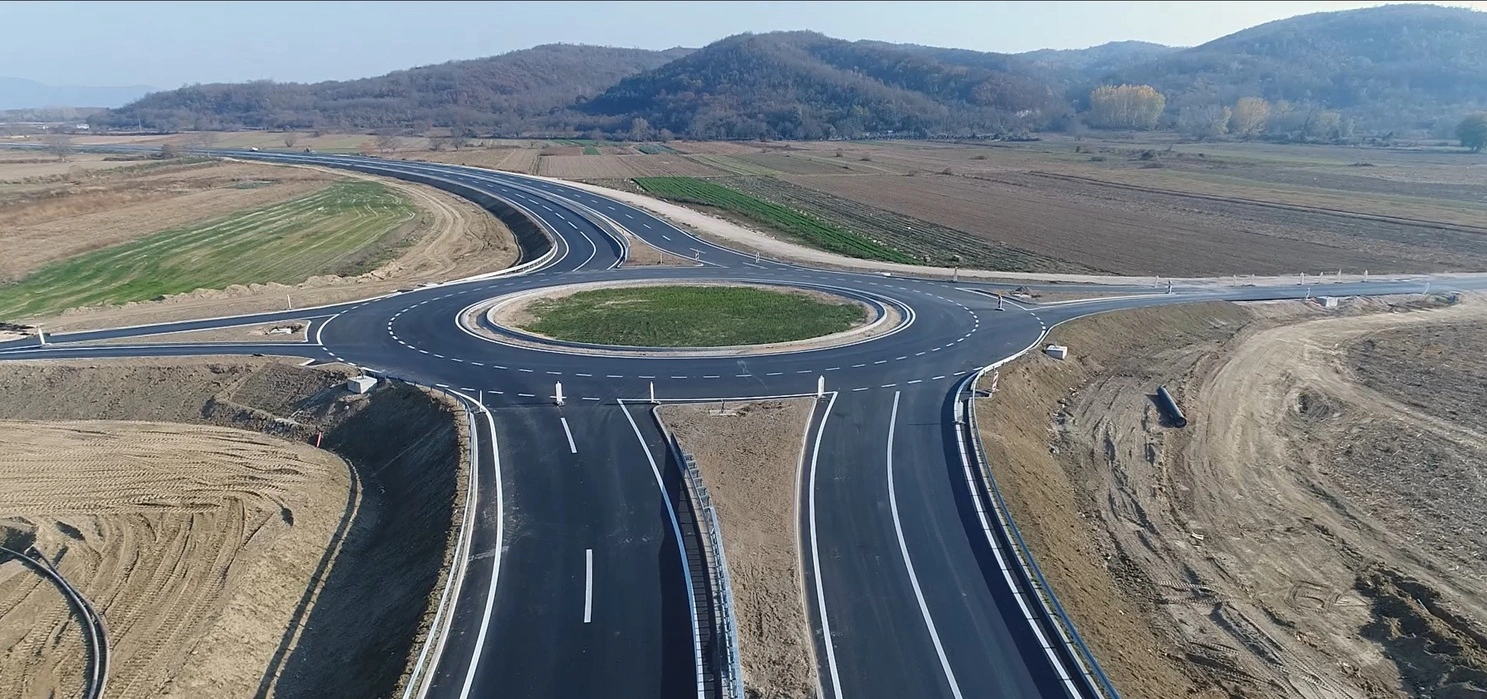
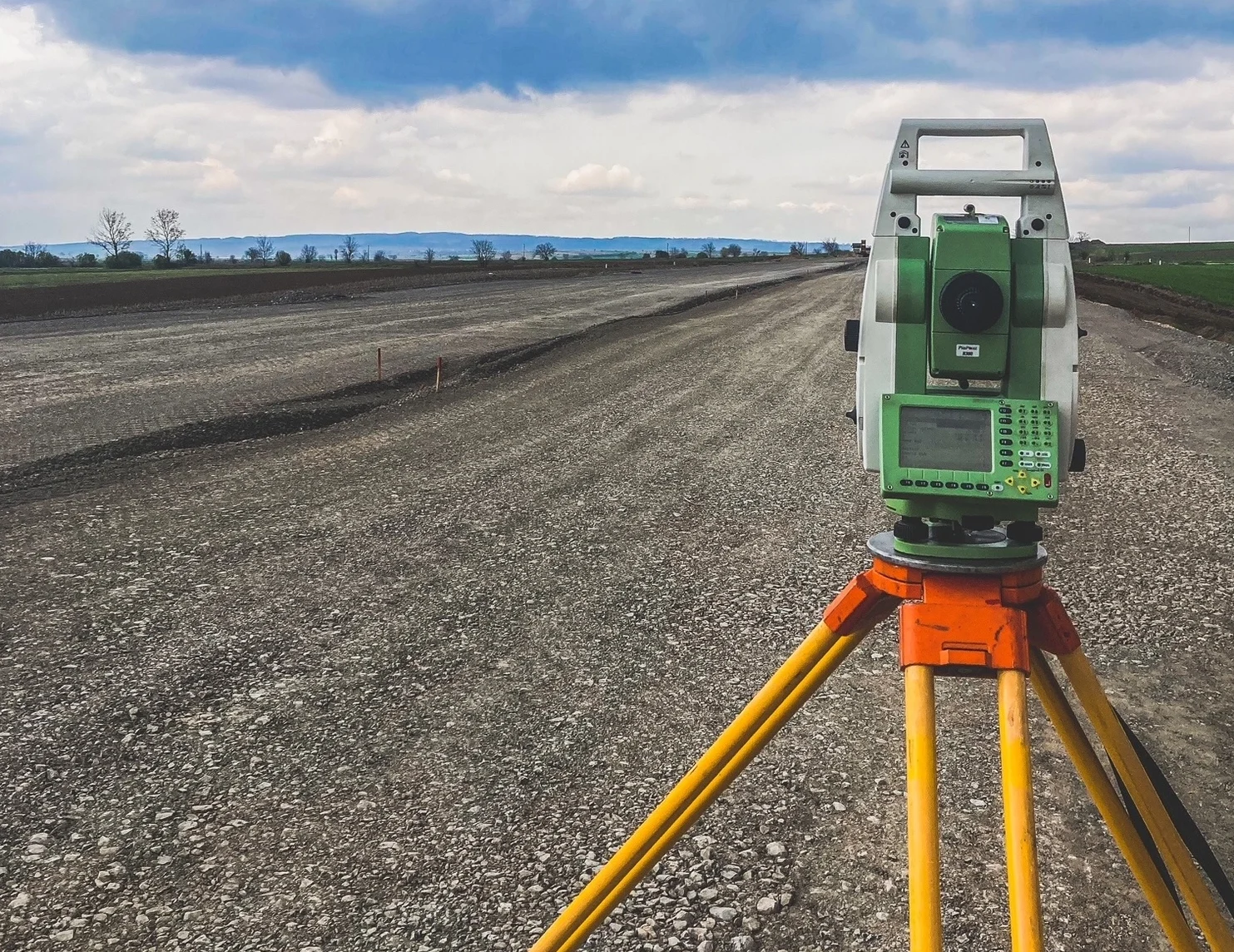
Project of the high-speed road Požarevac–Golubac
Geodetic Control & Reporting
- Location: Serbia
- Year: 03.2025.-Present
- Client: Ras Inzenjering d.o.o.
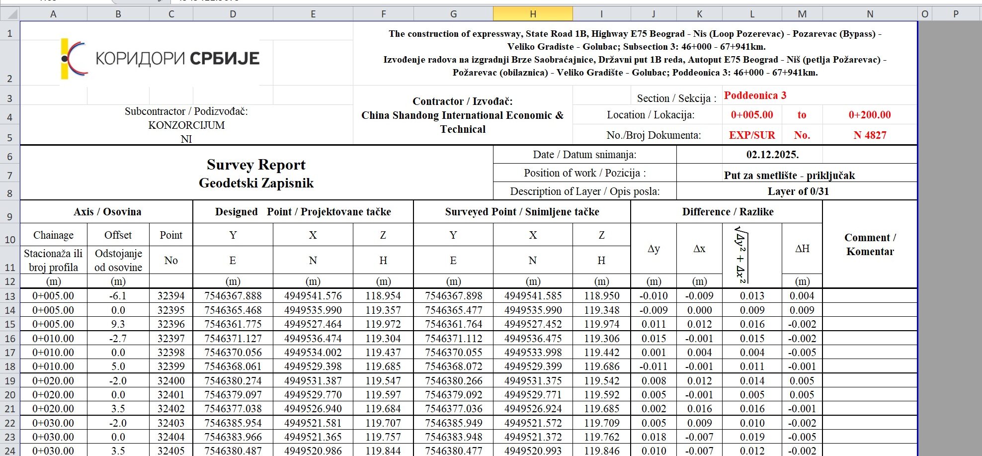
As a remote Lead Geodetic Engineer for RAS Inženjering, one of Serbia’s leading road construction companies, I am responsible for the complete preparation of geodetic documentation used for project control, supervision approval, and material payment tracking.
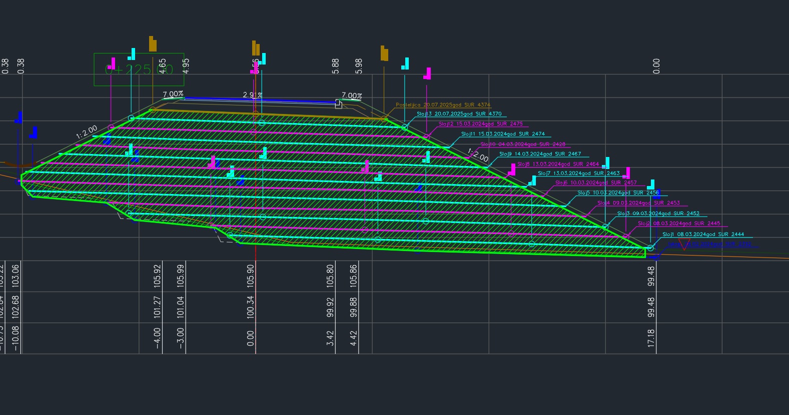
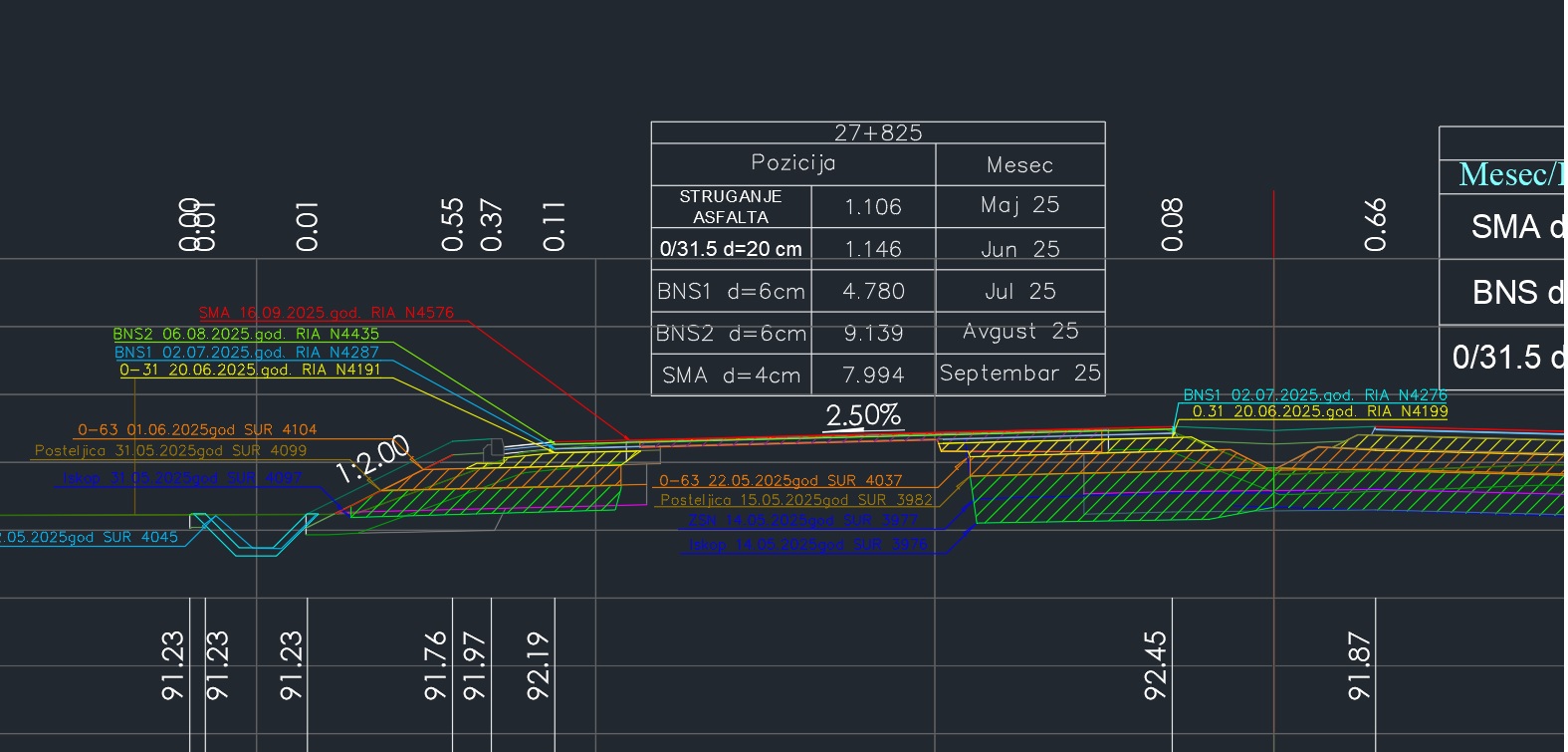
My daily work includes the preparation of detailed geodetic proof drawings clearly presenting executed pavement layers on cross-sections, with full technical references, dates, and identification codes.
In parallel, I prepare official geodetic records aligned with the presented layers and deliver weekly and monthly reports summarizing installed material quantities and surface areas, enabling accurate monitoring of construction progress and payment values.
Key responsibilities
Daily preparation of geodetic proof drawings (as-built cross sections)
Verification of executed asphalt and aggregate layers
Preparation of official geodetic records for project supervision
Quantity calculations of installed materials (area & volume)
Weekly and monthly progress and quantity reports
Remote collaboration with construction and supervision teams
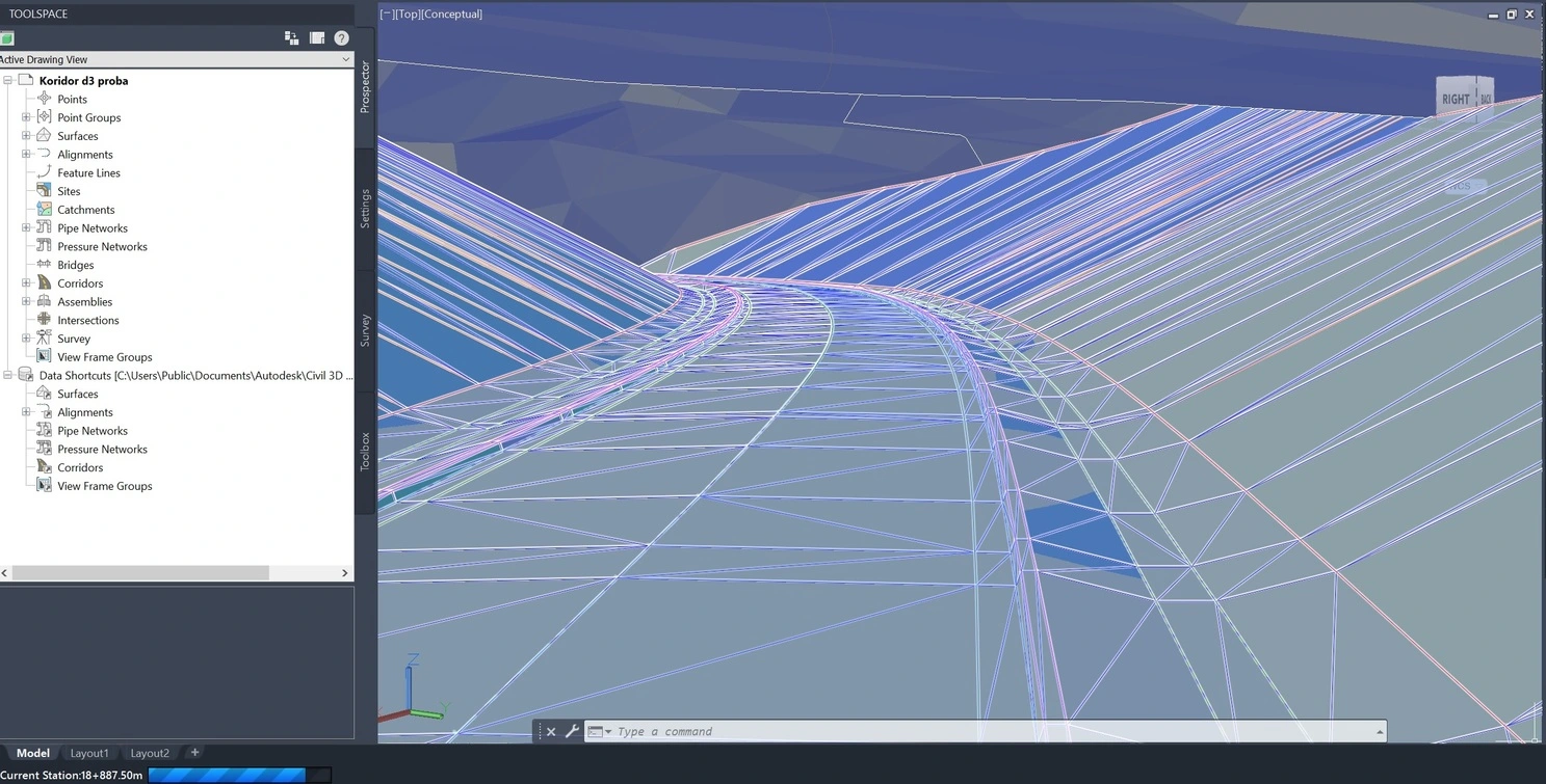
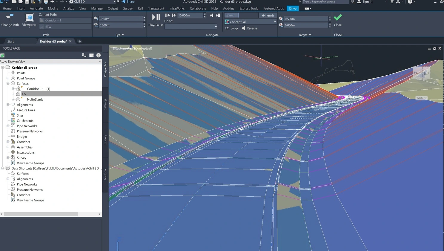
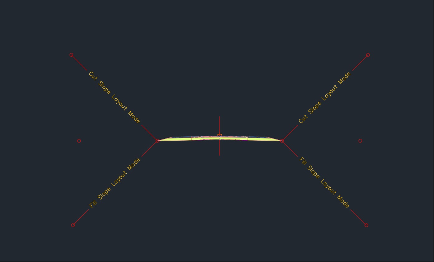
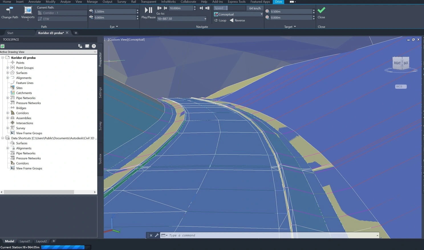
Data preparation and analysis in Civil 3D
Project of the high-speed road Požarevac–Golubac
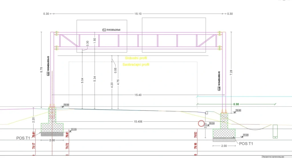
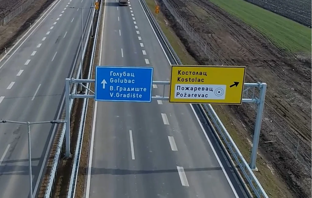
road signage
- Location: Serbia
- Year: 2023-Present
- Client: Signal d.o.o.
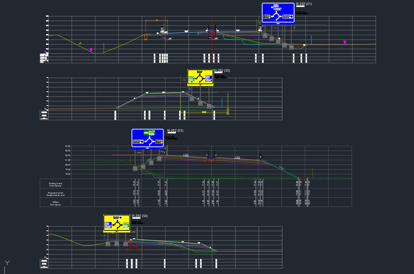
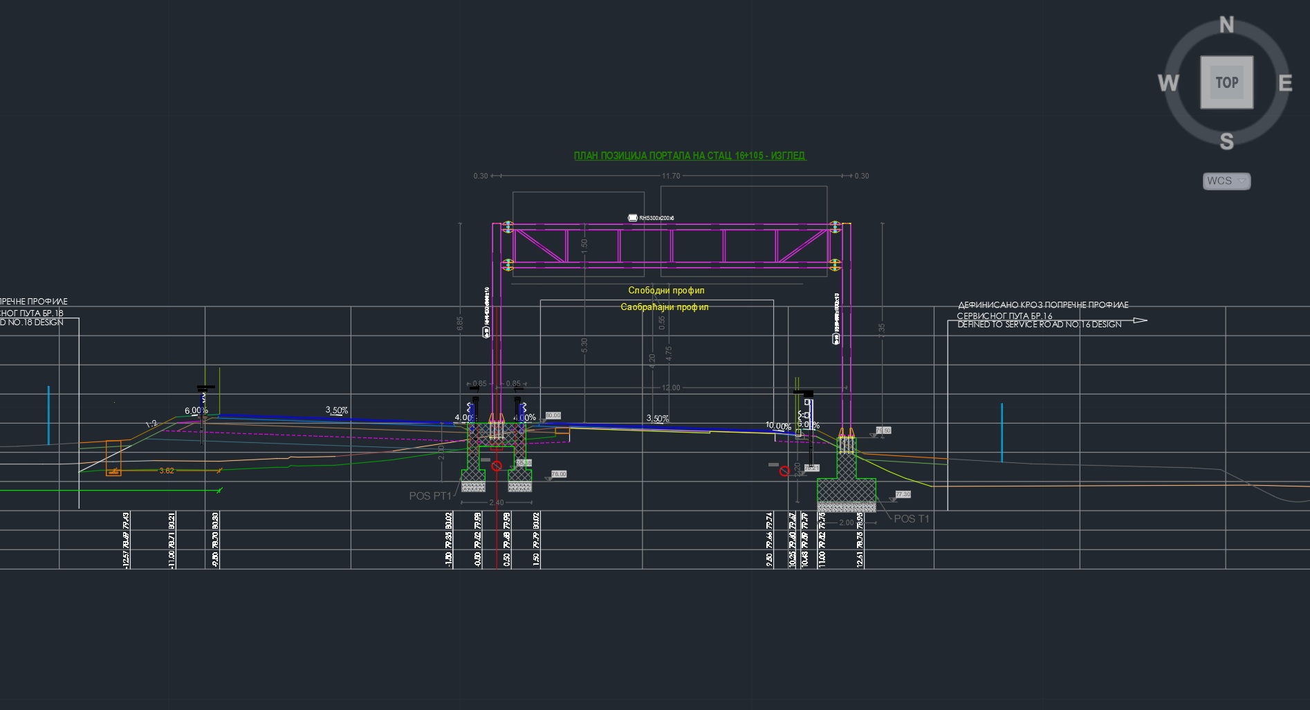

I worked as a subcontractor for Signal d.o.o. (Sombor), providing geodetic preparation and technical data for on-site layout and execution of road signage infrastructure.
Scope of work:
Preparation of geodetic data for horizontal road markings (white line layout)
Preparation of layout data for vertical traffic signs and portal structures
(including supporting structures and foundations above the roadway)Civil 3D–based data preparation for construction and installation
Execution of geodetic field works
Preparation and submission of official geodetic reports and records to the project supervision, used for work verification and payment approval
From Design to Reality
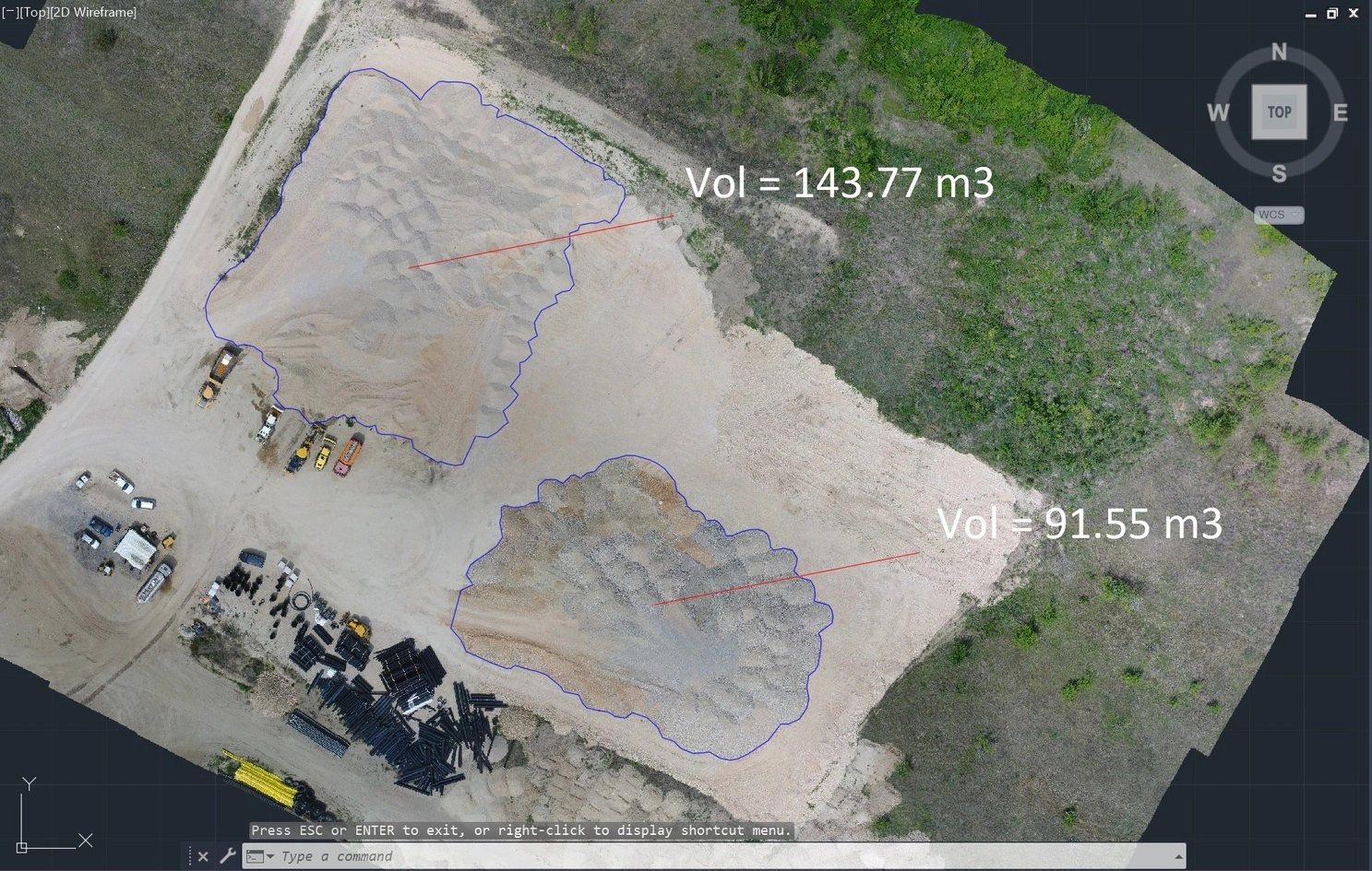
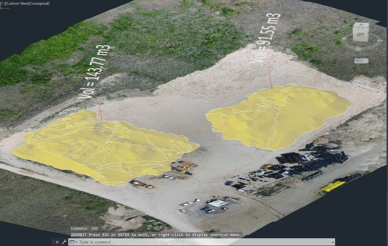
Drone-Based Material Stockpile Survey & Volume Calculation
More then
projects like this.
- Location: Serbia
- Year: 2025.
- Client: Stepcon d.o.o.
Project Description
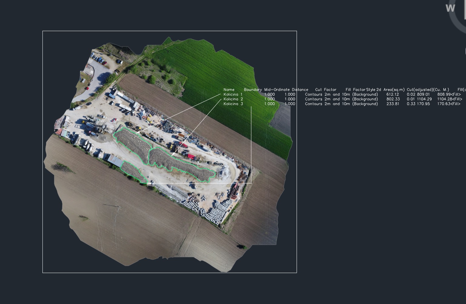
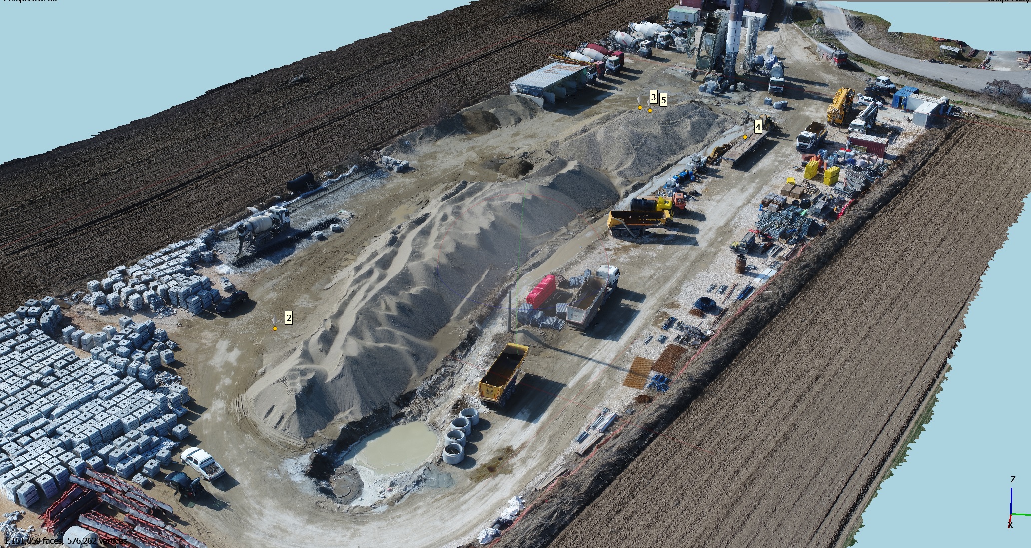
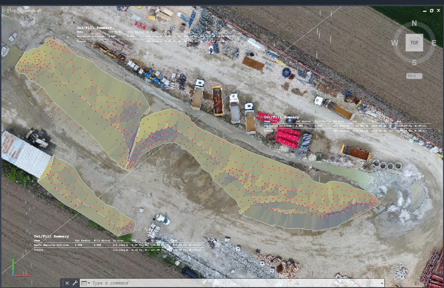
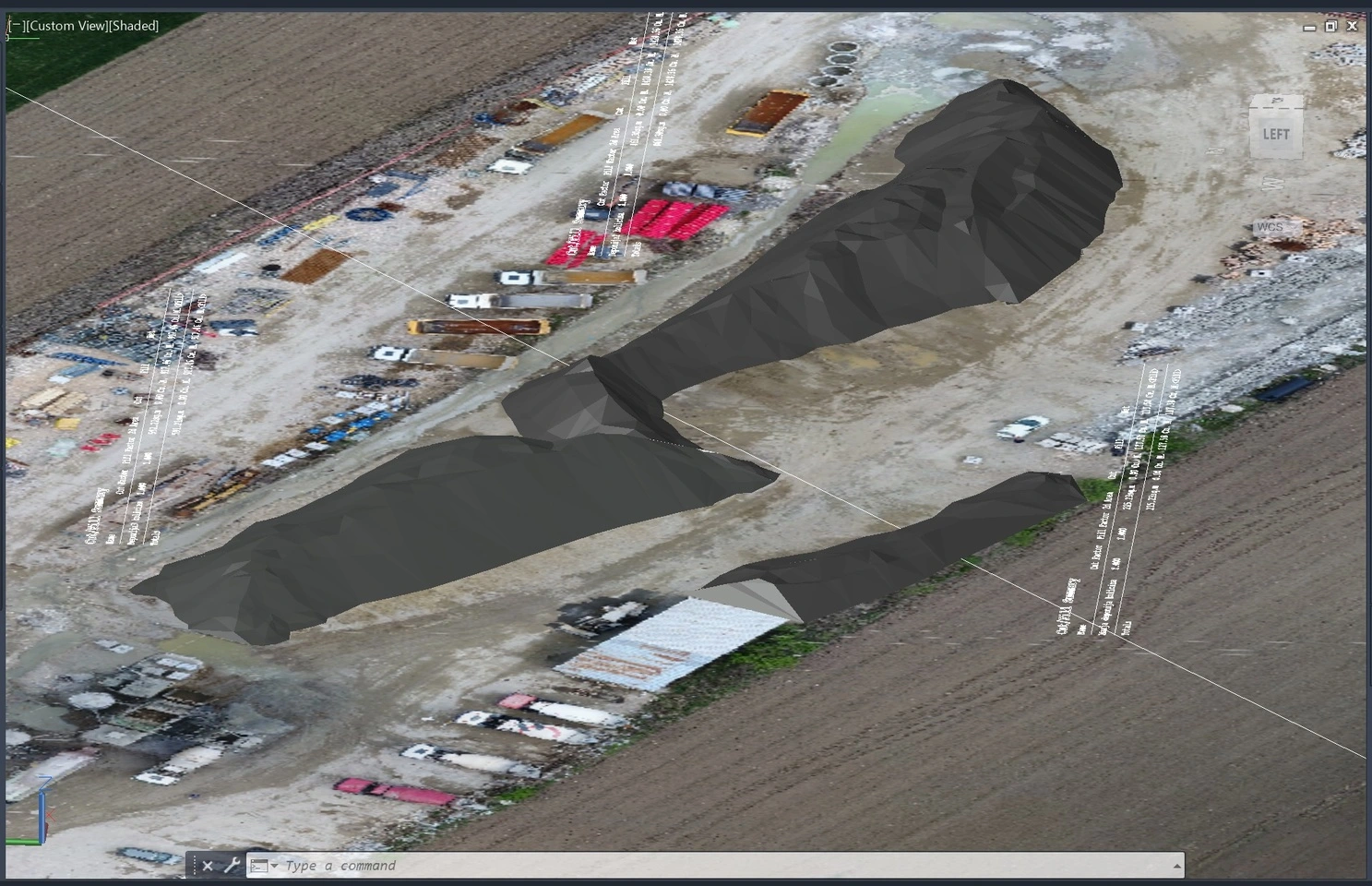
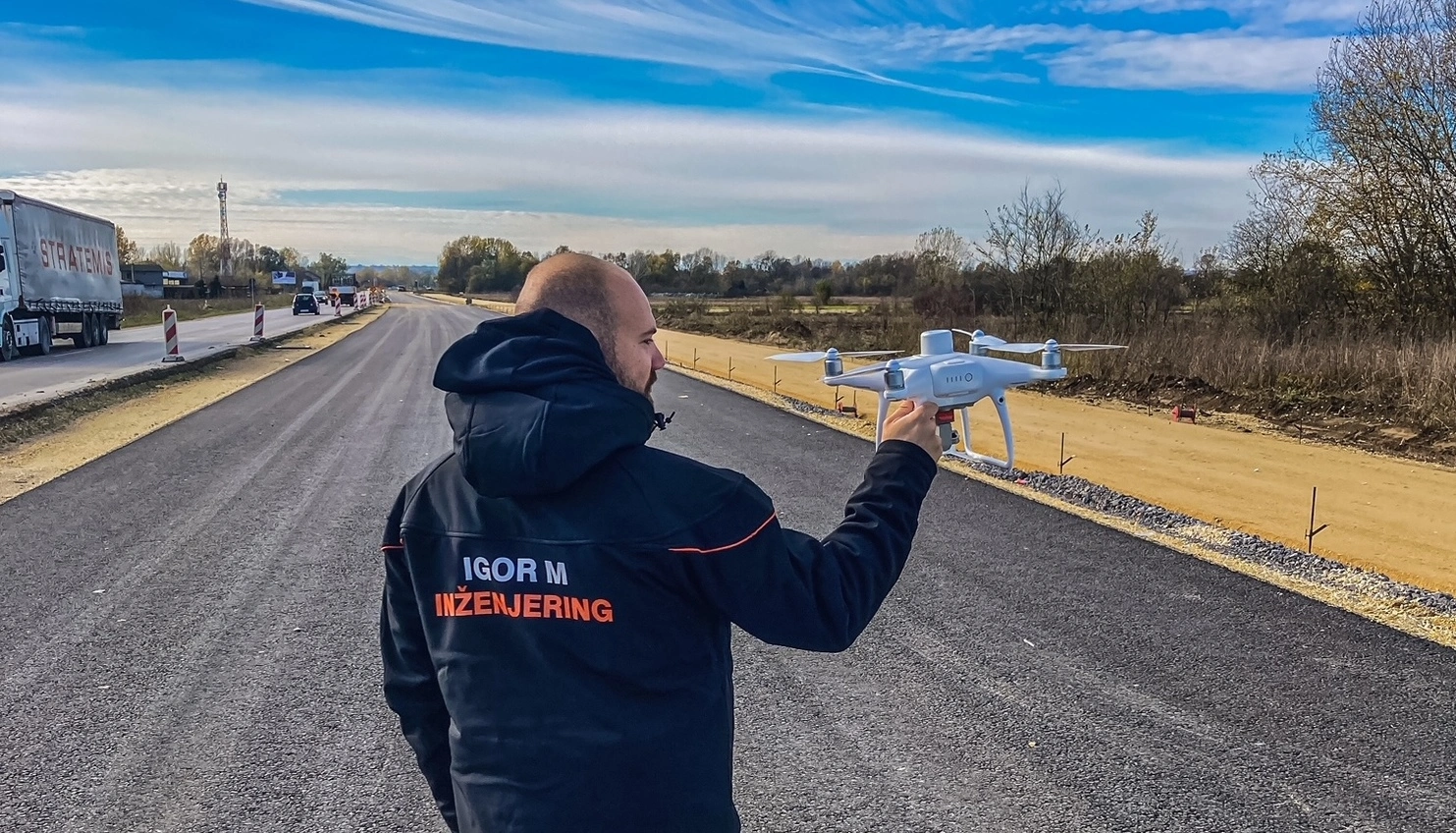
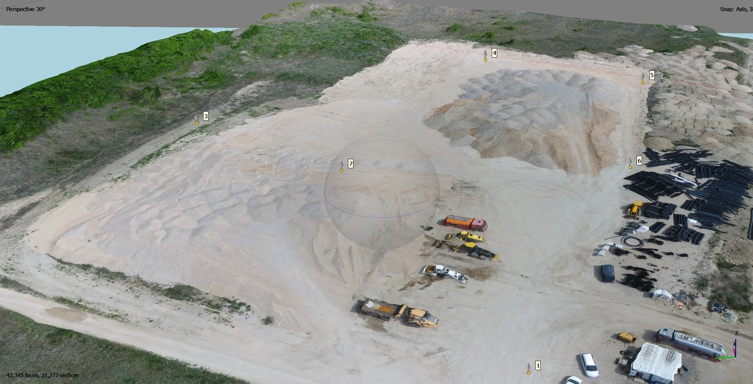
This project involved monthly drone surveys of multiple material stockpiles in order to monitor material consumption and accumulation over time. High-resolution aerial imagery was collected on a regular basis and processed using photogrammetry workflows to produce accurate 3D models of each stockpile.
Based on the generated 3D models, precise volume calculations were performed for every individual stockpile, allowing for reliable tracking of material changes between survey periods. Monthly reports were created to clearly present volume differences, supporting construction planning, inventory control, and decision-making processes.
This project represents one of several similar assignments where I performed recurring drone surveys and monthly volume reporting of material stockpiles, demonstrating consistent accuracy, repeatability, and long-term monitoring capabilities.
Results & Value for the Client
Accurate and up-to-date material quantities based on monthly measurements
Clear insight into material consumption and stockpile growth over time
Reliable data for cost control, billing verification, and financial planning
Reduced risk of quantity discrepancies and material losses
Fast and efficient data collection without disrupting site operations
Visual 3D documentation of stockpiles for reporting and audits
Consistent and repeatable monitoring methodology across multiple survey periods
Project of the high-speed road Požarevac–Golubac
Sections: D1, D2, D3
Geodetic engineer on site
- Location: Serbia
- Year: 2022-2025
- Client: Nukleus d.o.o.
- Duration: 3 years
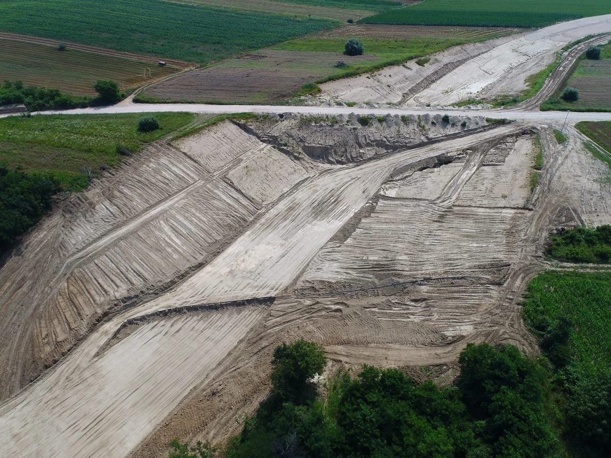
Nukleus is one of the largest construction companies in Serbia, specializing in heavy earthworks and road substructure preparation.
I was engaged through my own company as a geodetic engineer on the construction of the Požarevac–Golubac express road, covering all three project sections (D1, D2, D3).
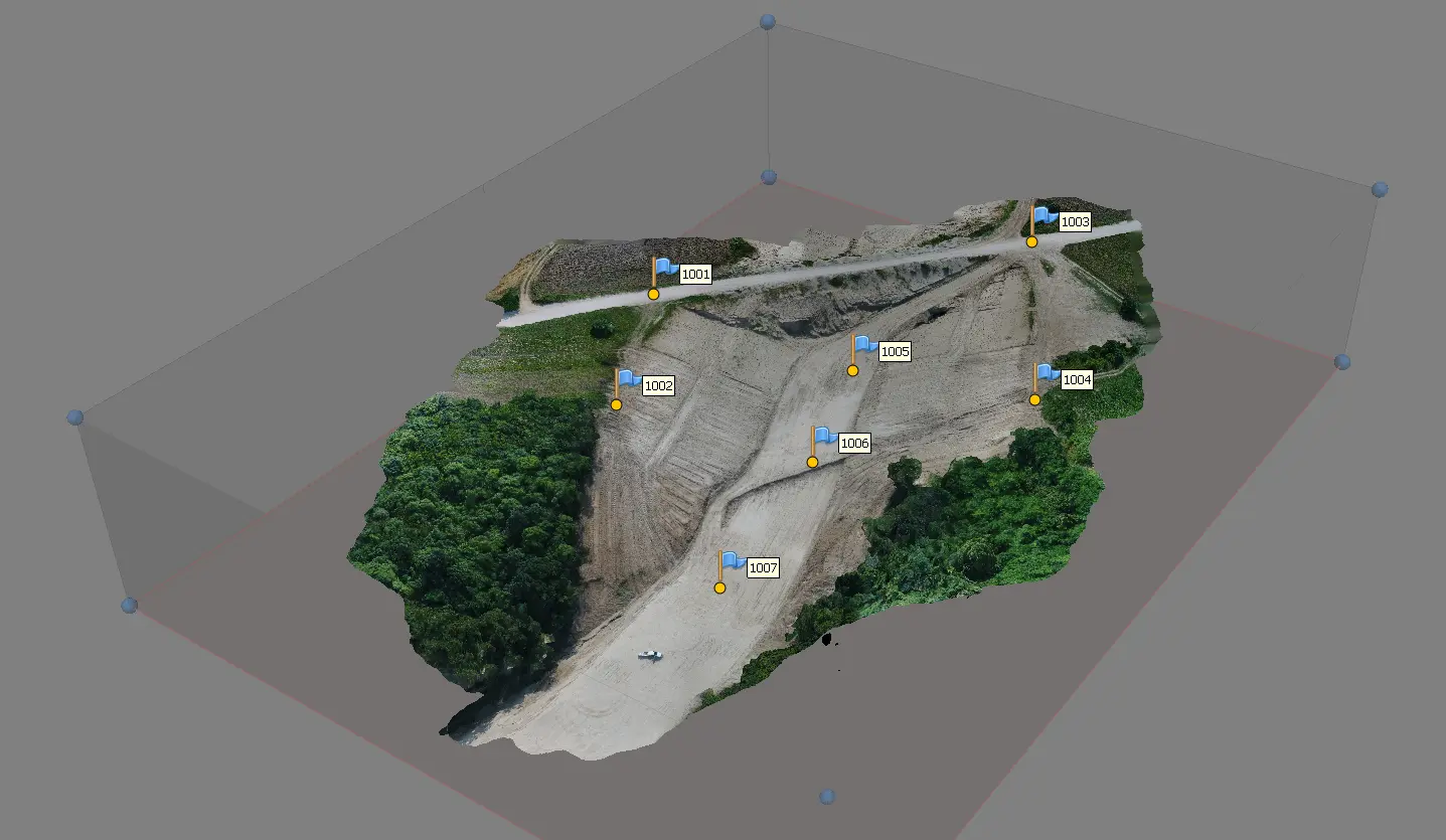
My role combined office-based technical preparation, on-site surveying support during construction, and independent quantity control through drone-based photogrammetry and monthly reporting.
My Responsibilities
Preparation of surveying and staking-out data based on road design documentation
Geodetic support for earthworks execution (cut & fill operations)
On-site staking-out of:
Road alignment (horizontal geometry)
Elevations and layers of the road structure
Continuous cooperation with site engineers and construction teams
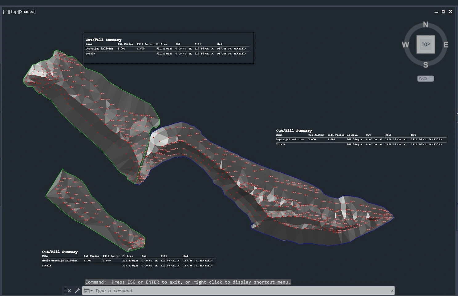
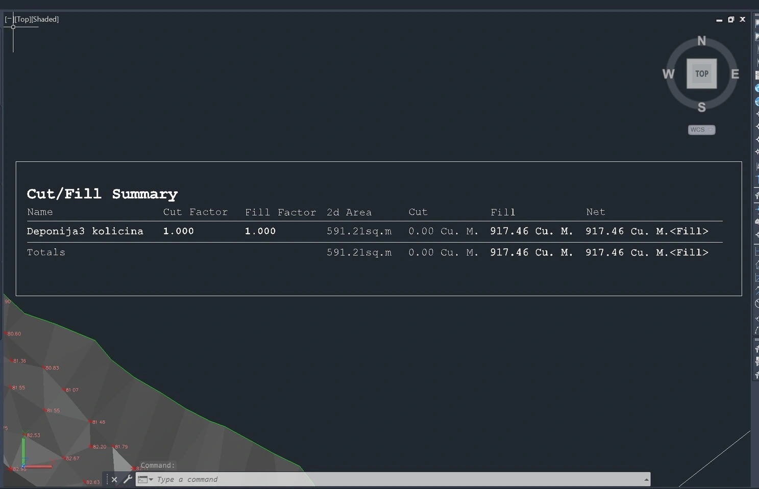
Drone surveying of material stockpiles (borrow pits and dumps)
Photogrammetric processing of drone data and creation of accurate 3D models
Calculation of material volumes from 3D models
Preparation of monthly quantity reports for material stockpiles
Independent control and verification of executed earthworks quantities